Tailwaters

Good dam fishing.

On a tailwater, the dam calls the shots. Tailwaters reads them for you — live releases, hourly forecasts, fly picks, and rising‑water alerts, starting with the White River below Bull Shoals Dam and the North Fork below Norfork Dam.

Built on USACE, USGS, NWS, SWPA & other data sources — timestamped, source‑labeled, and cached for the river.

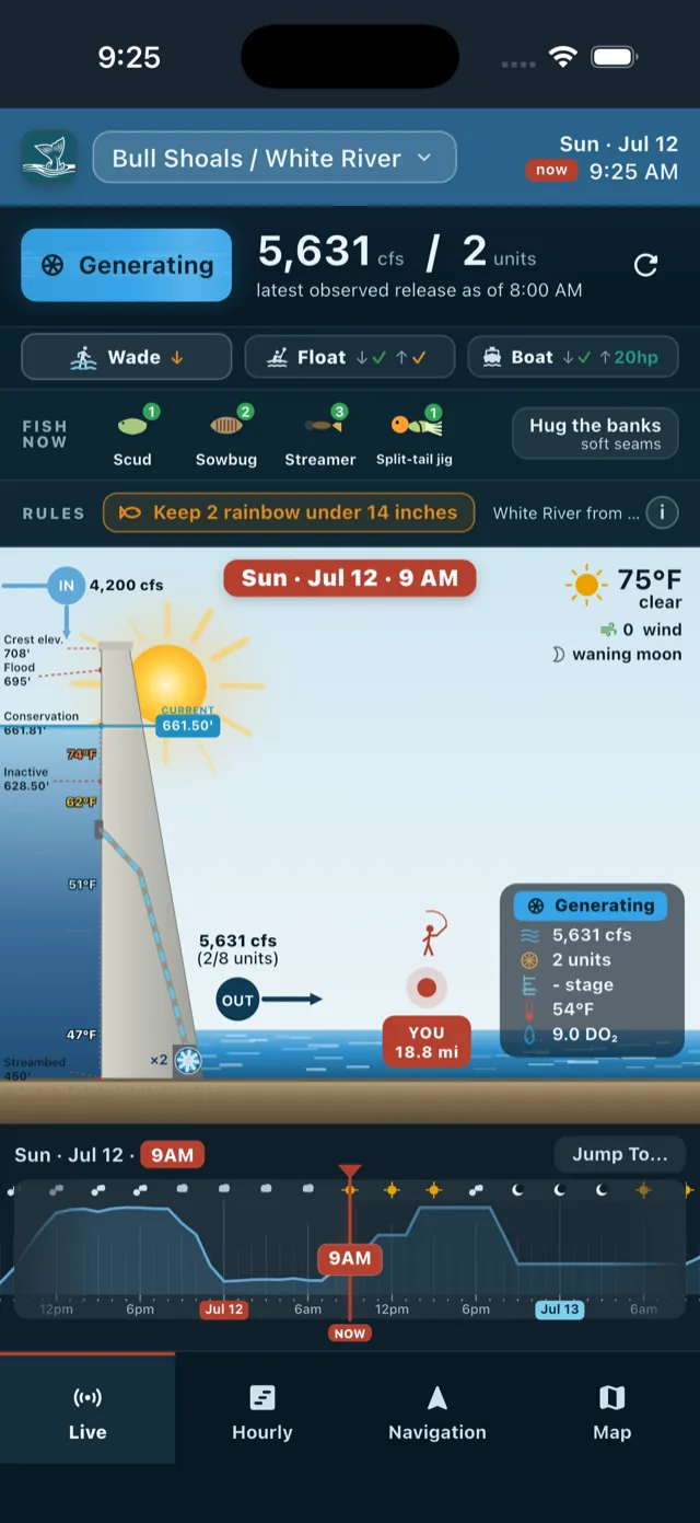
Tailwaters live view: Bull Shoals dam cross-section generating 5,631 cfs on 2 units, ranked fly picks, wade/float/boat guidance, and a 48-hour flow timeline

Watch the dam, live

Pool level, spinning units, release in cfs — and the water at your spot: stage, temperature, dissolved oxygen.

Scrub any hour

Drag the timeline through history or the days ahead, and the whole scene — water, sky, moon, numbers — follows.

Fish it right

Ranked fly picks, where‑to‑stand advice, wade/float/boat calls, and today's regulations on one screen.

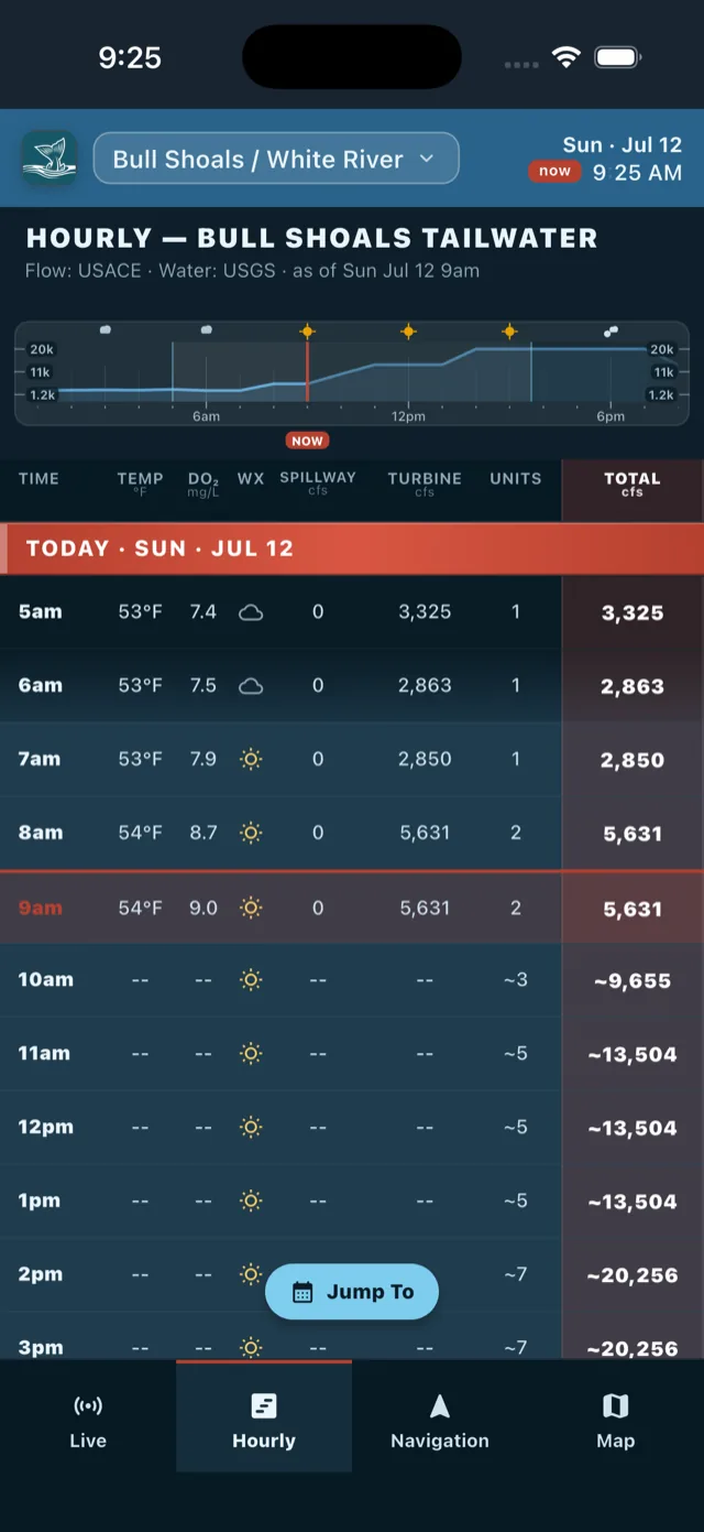
Hourly table for Bull Shoals tailwater: temperature, dissolved oxygen, weather, spillway, turbine, units, and total cfs for each hour, observed and projected

Plan around the water, hour by hour

Turbine, spillway, units, and total flow — with water temp, DO₂, and weather for every hour. Scroll endlessly through history or jump to a date. Forecasts are marked, and every value names its source.

Flow: USACE & SWPA · Water: USGS · Weather: NWS
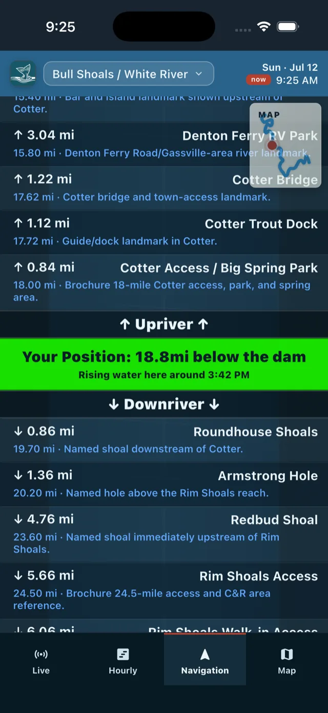
River navigation: landmarks upriver and downriver of your position 18.8 miles below the dam, with rising water expected at 3:42 PM

Know when rising water reaches you

GPS pins you to the river — miles below the dam, landmarks upriver and down. When generation ramps, Tailwaters estimates when the surge reaches your position, and push alerts can warn you while it's still wadeable.

Wade, float & boat guidance grounded in the USACE hydraulic model.

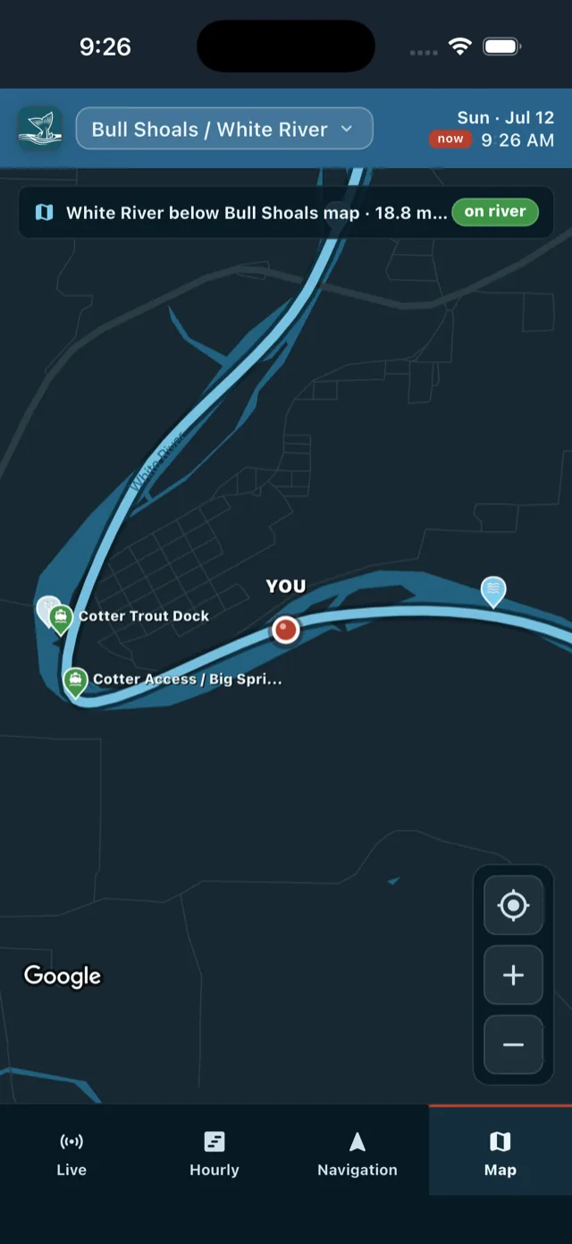
Map view: White River course below Bull Shoals with access points, Cotter Trout Dock, and your position on the river

Every ramp, shoal, and access point

The whole river, mile by mile — boat ramps, wade access, named holes, bridges, and gauges on a live map, with you on it.

Works in navigation-list or map view.

More edges, built in

  • Fly picks with receipts

    FISH NOW ranks patterns for season, light, weather, and flow — backed by local hatch reporting.

  • Rules that track the date

    Current AGFC trout regulations — including emergency changes — right where you plan.

  • Weather, fish‑first

    Wind, pressure trend, and moon phase, color‑coded by fishing influence. NWS alerts built in.

  • Water quality, hourly

    Temperature and dissolved oxygen from USGS gages — in the table and at your spot.

  • Alerts where you fish

    Rising‑water and weather notifications targeted to the tailwater you're actually on.

  • Works riverside

    Cached‑first and refreshed in the background, so it opens fresh on one bar of signal.

Two tailwaters, in depth: the White River below Bull Shoals Dam — 44 modeled river miles — and the North Fork below Norfork Dam. Fish somewhere else? Request your tailwater in the app.

Request

The dam has a schedule. Now you do too.

Questions, comments, issues — hello@damtailwaters.com

Tailwaters is a planning tool, not a warning system. Water can rise faster than any forecast — when in doubt, get out.